As part of a two-year project with National Oceanic and Atmospheric Administration (NOAA) Fisheries Northeast Fisheries Science Center, Marine Mammals of Maine, and Cummings School of Veterinary Medicine at Tufts University, Atlantic Marine Conservation Society “AMSEAS” kicked off year two in January 2020 to conduct health assessments of gray seals in the northwest Atlantic. This project is critical in understanding how the species moves throughout the region, providing greater understanding into the ways in which they utilize the marine environment through health assessments and disease surveillance.
Over the last two decades, these projects have gained momentum and provided the backbone for the satellite tracking project undertaken over the past two years. AMSEAS received support from the National Marine Sanctuary Foundation during the fall of 2018 to monitor gray seal movements in the northwest Atlantic using satellite tags. This support enabled AMSEAS to purchase sixteen satellite tags.
Despite the challenges presented by the longest government shutdown in history, which deprived the project of the logistical vessel support needed for the project, we were able to secure a vessel to Great Point, Nantucket on January 26, 2019. From the UMASS Boston Field Station, we traveled to a smaller boat to head to Muskeget Island to sample gray seal pups. We sampled eight animals, seven of which received satellite tags. We returned back to the main island of Nantucket to prepare for sampling on Great Point the following day.
Upon arriving on Great Point on the morning of January 27, 2019, we observed hundreds of adult gray seals on the beach. We sampled 15 animals and attached two satellite tags.

Gray seal hauled out on Seal Island, Maine, January 2020.
Click the map below to track animals satellite tagged in 2019

2019 satellite tagged animal tracking map
The 2020 season for this project began on January 13, 2020. Our team departed from Woods Hole, Massachusetts in mustang exposure suits for safety and loaded all gear for sampling and satellite tagging. A two-person drone team also accompanied the crew to conduct aerial surveys while the rest of the team completed the health assessment field work. Two boats transported the crew across rough seas to Muskeget Island, just off Nantucket. The ride, which would normally take 45-minutes, took two hours. Read more about our work and utilizing the R/V Gloria Michelle for this trip here.
Seal Island, Maine was the next location for our mission. We worked with Maine Marine Patrol to travel to the island about their vessel, Guardian II. While there, we rescued a seal from a well and also satellite tagged seven other animals.
Partial funding for this program was provided by the National Marine Sanctuary Foundation.
Team rescuing a gray seal from a well.
Click the map below to track animals satellite tagged in 2020

2020 satellite tagged animal tracking map
For more information on this project, contact AMSEAS Chief Scientist Robert A. DiGiovanni, Jr. at rdigiovanni@amseas.org.


Gray seal in Great Point, Nantucket, January 2020.
Satellite tags for gray seals.
John Runstadler and Rob DiGiovanni, Atlantic Marine Conservation Society.
Team landing on Seal Island, Maine.
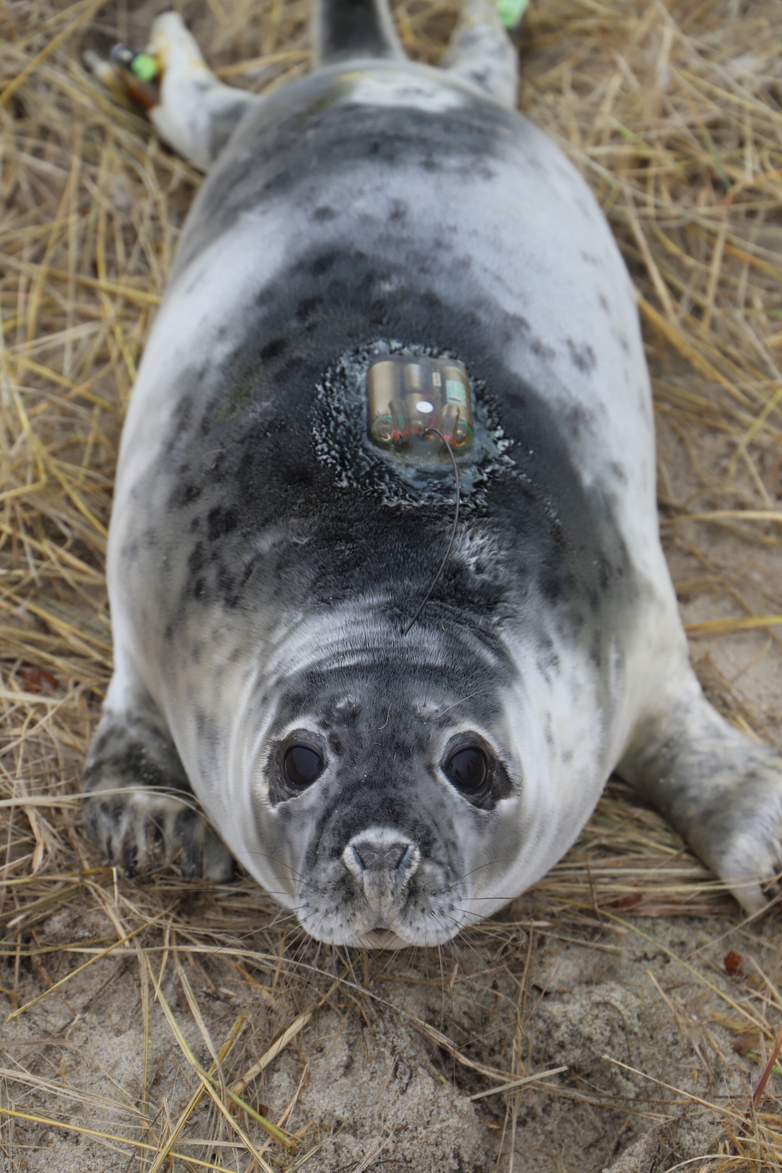
Gray seal with satellite tracking tag on Muskeget Island off Nantucket, Massachusetts, January 2020.
Seal rescued from well on Seal Island, Maine.
R/V Gloria Michelle that transported the team to Muskeget.
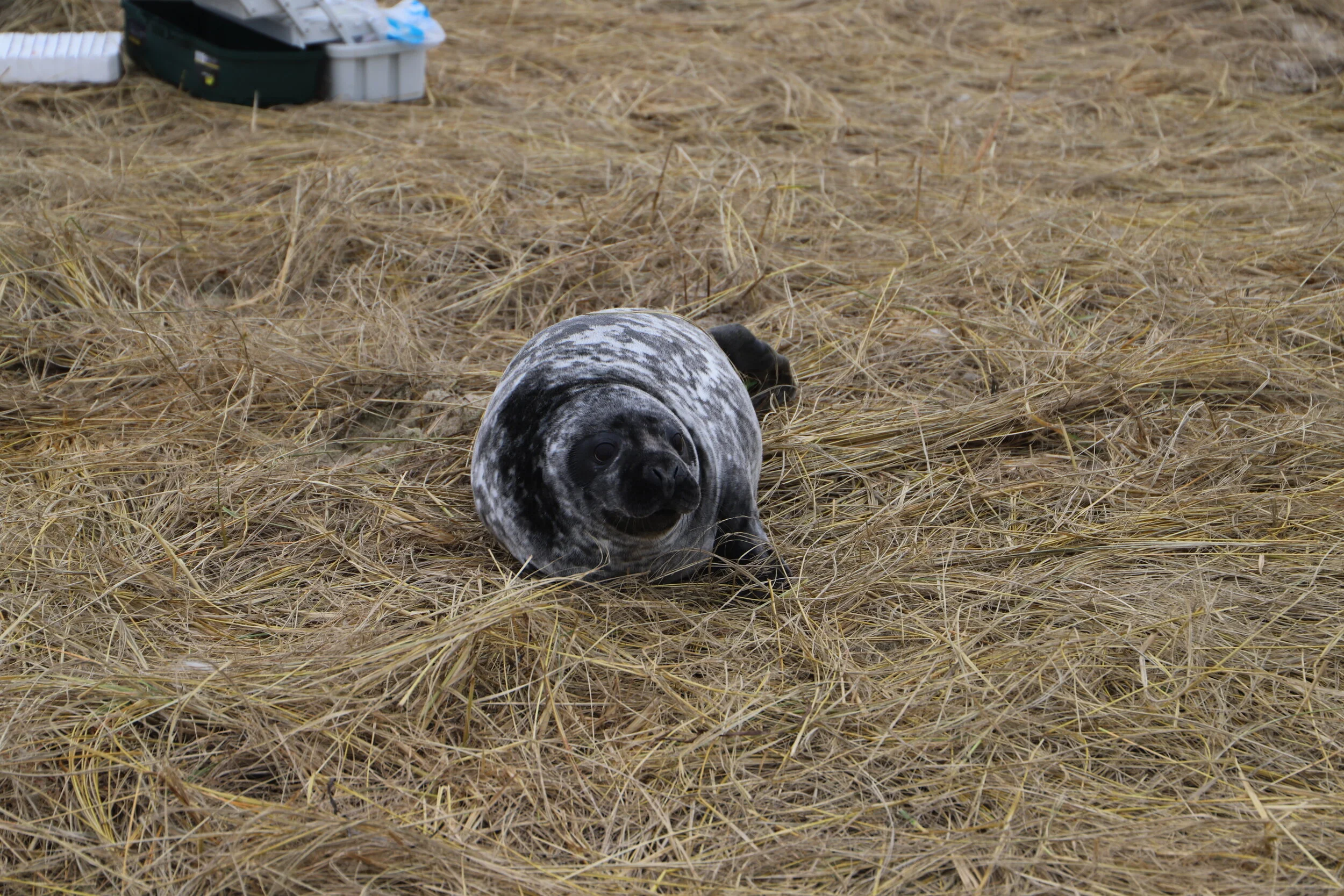
Gray seal pup on Seal Island, Maine.

Sample location of Muskeget and Great Point

Sample locations in Southern New England and Maine
